

City guide
Kohat: Gateway Through the Pass
A garrison and market town in a bowl of dry hills south of Peshawar, known for its guavas, its British-era fort and the tunnel that carries the Indus Highway beneath the Kohat Pass.
- Khyber Pakhtunkhwa (Kohat Division)
- Altitude about 490 m
- On the Indus Highway (N-55)
- Best season: October–March
Kohat valley, Khyber Pakhtunkhwa
Kohat at a Glance
About Kohat
Kohat lies in a valley of low, dry hills south of Peshawar, just north of the Kohat Toi stream. The town grew at the southern end of the Kohat Pass, the route through the hills of the Afridi country that links the Peshawar Valley with the southern districts of Khyber Pakhtunkhwa. It is the headquarters of Kohat District and Kohat Division, a cantonment and air-force town, and a market centre for the farming villages around it.
The 2023 Census counted 204,829 people in the municipal area and 31,051 in Kohat Cantonment, 235,880 in all, and 1,234,661 in Kohat District. Pashto is the main language of the district; the town also has a long-established Hindko-speaking community whose local dialect is known as Kohati.
The heart of Kohat is its British-era fort, surrounded by bazaars and the leafy cantonment. The town is famous across Pakistan for its guavas, and it is the seat of the armed forces' Inter Services Selection Board, which brings young officer candidates here from all over the country. A few kilometres west, Tanda Dam holds back a reservoir that is protected as a Ramsar wetland for wintering waterbirds.
Since the Kohat Tunnel opened in the early 2000s, most traffic on the Indus Highway runs under the pass rather than over it, and Kohat has become a key stop on the road from Peshawar to Bannu and Dera Ismail Khan. Kohat Division has seen security incidents in recent years, so travellers should check current advisories before visiting.
Kohat has always been a town you pass through on the way somewhere, which is exactly why it matters.
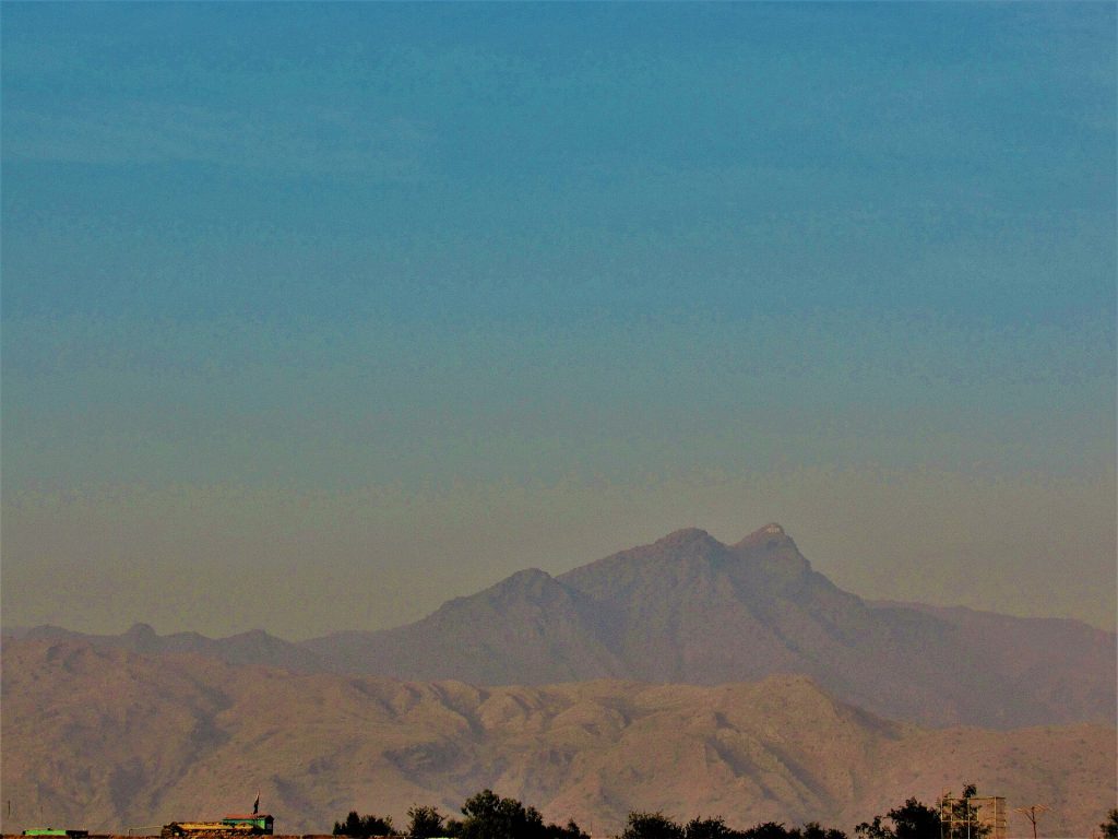
Things to See in and Around Kohat
Forts, a historic pass and a quiet wetland.
 Kohat Fort and the old townThe British-built fort stands near the centre of the new town, ringed by bazaars. Much of it is still in official use, so view it from outside and don't photograph guards or gates.
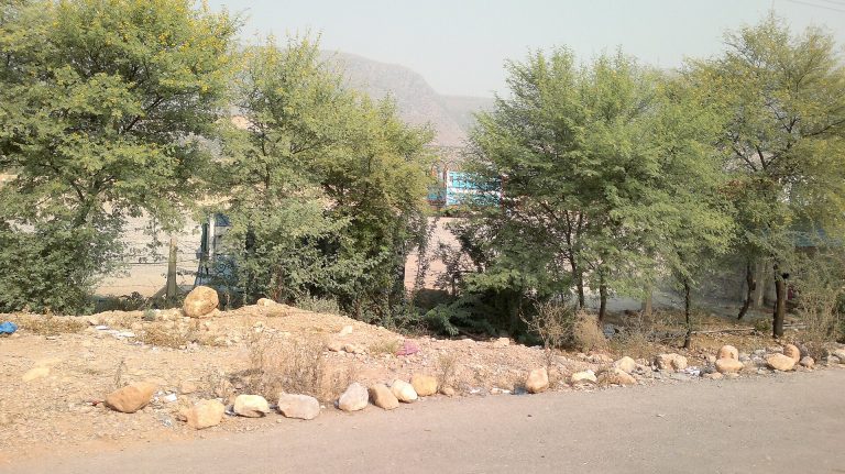 Kohat PassThe old road over the pass, completed by the British in 1850, winds through the hills towards Peshawar. It is a historic route through tribal country, ask locally before driving it rather than the tunnel.
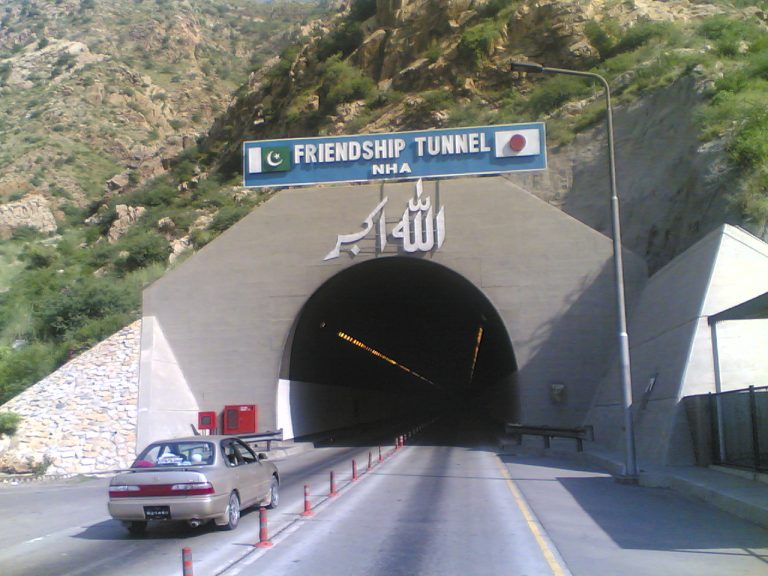 Kohat TunnelA 1.9 km road tunnel on the Indus Highway, built with Japanese financing, which shortened the Peshawar–Kohat road by about 20 km and spared drivers the climb over the pass.
 Tanda DamA small irrigation reservoir completed in 1967 and designated a Ramsar site in 1976 as a wintering ground for ducks and other waterbirds. Locals come for picnics and fishing.
 Ghamkol SharifA large mosque and khanqah of the Naqshbandi Sufi order outside the town, which draws many devotees, especially at gatherings.
A Short History of Kohat
Early history
Raja Kohat
Tradition holds that the original town, some distance from today's, was founded by a Buddhist ruler called Raja Kohat, after whom it is named.
1505
Babur's raid
The future Mughal emperor Babur plunders Kohat during an early foray into the region, and records in his memoirs that its riches had been exaggerated.
1849–1850
British rule
The British annex the area in 1849 and complete a road over the Kohat Pass in 1850.
1870s
Municipality and cantonment
Kohat is made a municipality in 1873, and the military cantonment grows alongside the new town and its fort.
1924
Communal riots
Deadly communal rioting in Kohat leads Mahatma Gandhi to undertake a 21-day fast for Hindu–Muslim unity.
1967 and 1976
Tanda Dam
Tanda Dam is completed in 1967; in 1976 its reservoir becomes one of Pakistan's first Ramsar wetland sites.
Early 2000s
Kohat Tunnel
A Japanese-financed tunnel opens under the Kohat Pass on the Indus Highway, transforming road links between Peshawar and the south.
Getting There and Around
By road
Indus Highway via the tunnel
Kohat is on the Indus Highway (N-55) between Peshawar and Bannu/Dera Ismail Khan; most traffic uses the Kohat Tunnel. Roads also link Kohat east towards Rawalpindi and west to Hangu.
By air
Via Peshawar
The nearest airport with regular flights is Bacha Khan International Airport in Peshawar. Kohat's own airfield is a Pakistan Air Force base.
By rail
Historic branch line
A British-era branch line connects Kohat with the main network via Jand, but passenger services are limited; road travel is far more practical.
Around town
Rickshaws and wagons
Rickshaws and minibuses serve the town and nearby villages. Hire a car with a local driver for trips outside town.
Plan Your Visit
Best time to visit
October to March
Winters are mild and sunny and the guava season is in full swing. Summers in the valley are very hot.
Where to stay
Limited choice
Kohat has a handful of local hotels; most visitors come on a day trip from Peshawar or break the journey on the Indus Highway.
Etiquette
Conservative Pashtun town
Dress modestly, keep photography of people respectful and ask first, and avoid photographing military, air-force or police sites.
Advisories
Check before you go
Kohat Division, including the Darra Adam Khel area on the old road to Peshawar and the roads towards Hangu and Kurram, has seen militant violence in recent years. Check current travel advisories and local authority guidance; foreign visitors should confirm NOC requirements.
Nearby Cities
 PeshawarThe provincial capital, with its walled city, Peshawar Museum and food streets, lies north through the tunnel.
 BannuSouth along the Indus Highway, a historic market town on the Kurram River famous for its beef pulao.
 Dera Ismail KhanThe Indus Highway continues to D.I. Khan on the river, home of sohan halwa and the ancient mound of Rehman Dheri.


Frequently Asked Questions
What is Kohat famous for?
Its guavas, the Kohat Pass and tunnel, its British-era fort and cantonment, the Tanda Dam wetland and the Inter Services Selection Board, which selects officer candidates for the armed forces.
What is the population of Kohat?
The 2023 Census counted 235,880 people in Kohat city including its cantonment (204,829 in the municipal area) and 1,234,661 in Kohat District (Pakistan Bureau of Statistics).
How long is the Kohat Tunnel?
About 1.9 km. Built with Japanese financing, it carries the Indus Highway under the Kohat Pass and shortened the road between Peshawar and Kohat by around 20 km.
Is it safe to travel to Kohat?
Kohat city is a busy garrison and market town, but the wider division has seen militant attacks in recent years. Check current government travel advisories and local guidance before travelling, and stick to main roads.
What languages are spoken in Kohat?
Mainly Pashto, with a Hindko-speaking community whose dialect is called Kohati. Urdu is widely understood.
Keep Exploring
Related places and stories on DailyLife.pk
PeshawarPeshawar city guide: Qissa Khwani Bazaar, Mahabat Khan Mosque, Sethi House, Peshawar Museum, Pashtun foodBannuBannu city guide: the Kurram River plain, the old fort and gates, Akra moundsDera Ismail KhanD.I. NowsheraNowshera city guide: the Kabul River, Akora Khattak and Khushal Khan Khattak's tomb, RisalpurThe British Colonial EraBritish rule in Pakistan 1843–1947: conquest of Sindh and Punjab, the North-West Frontier, railways, canal colonies
 Birds of PakistanBirds of Pakistan: the chukar (national bird), pheasants, raptors, houbara, cranes and waterbirds, top birding wetlands
How we know this
- Type Place guide
- Sources 6 (2 official/academic)
- Reviewed October 2026
- Disputed points None
6 sources
- Pakistan: Khyber Pakhtunkhwa – cities, towns and districts (Census 2017 and 2023), City Population (Thomas Brinkhoff), citing Pakistan Bureau of Statistics
- Census 2023 – Table 2: Population of urban localities, Khyber Pakhtunkhwa, Pakistan Bureau of Statistics
- Kohat, Encyclopaedia Britannica
- Tanda Dam (Ramsar Site no. 98), Ramsar Sites Information Service
- Kohat tunnel ready for commissioning, Dawn
- Kohat, Wikipedia (used to locate primary sources)
Photo credits (6)
- Kohat Velly.jpg, Fidakhan 1, CC BY-SA 3.0, via Wikimedia Commons
- Mountains in Kohat City.jpg, Noorjehan, CC BY-SA 4.0, via Wikimedia Commons
- Kohat Peshawer road 7 - panoramio.jpg, Rizwan Ullah Wazir, CC BY 3.0, via Wikimedia Commons
- Kohat tunnel - panoramio.jpg, Manzoor Ahmad, CC BY 3.0, via Wikimedia Commons
- Kohattanda.jpg, Aftabbanoori, CC BY-SA 4.0, via Wikimedia Commons
- Ghamkol Shareef Kohat, KPK Pakistan.jpg, Ghazala.andaleeb, CC BY-SA 4.0, via Wikimedia Commons
