

City guide
Bannu: Market Town of the Kurram Plain
A historic garrison and market town on the Kurram River in southern Khyber Pakhtunkhwa, founded as a British fort in 1848 and known nationwide for its slow-cooked beef pulao.
- Khyber Pakhtunkhwa (Bannu Division)
- On the Kurram River
- Altitude about 375 m
- Check advisories before travel
Akra mound, Bannu
Bannu at a Glance
About Bannu
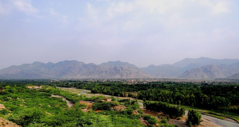
Bannu sits just south of the Kurram River on a roughly circular, fertile plain ringed by low hills, in the south of Khyber Pakhtunkhwa. The Kurram and its tributary the Tochi (also called the Gambila) drain the basin, and their water has made the plain a green island of wheat, maize and barley in otherwise dry country. The town is the headquarters of Bannu District and Division and the main market for the plain and the hill country of North Waziristan to the west.
The 2023 Census counted 41,015 people within the municipal limits and 7,383 in the cantonment, 48,398 in all. Those boundaries are tightly drawn: the built-up area and its surrounding villages are much larger, and Bannu District as a whole had 1,357,890 people. Most residents are Pashtuns of the Banuchi tribe and speak their own Pashto dialect; Urdu is widely understood.
The modern town began in 1848, when the British officer Herbert Edwardes built a fort and military base here. It was first called Dalipnagar, after the boy Maharaja Duleep Singh of Lahore, then Edwardesabad, and finally took the name Bannu in 1903. The cantonment, the old bazaar with its gates and a busy weekly Friday market still shape the town.
To most Pakistanis, Bannu means one thing: Bannu beef pulao, a rich dish of bone-in beef and rice now sold in restaurants from Karachi to the Gulf. Bannu is also a gateway to Waziristan and has been badly affected by militancy, so any visit needs careful, up-to-date planning.
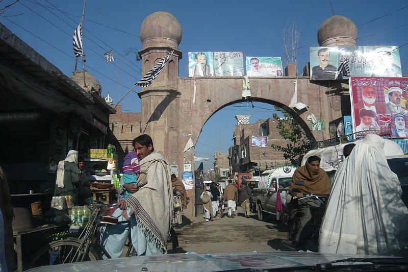
Places of Interest
A small, working town with a long history.
 Bannu Fort and cantonmentEdwardes's fort of 1848 was the seed of the town; the cantonment around it remains a military area, so admire it from public roads only.
 The old gates and bazaarGates such as the Meryan Gate mark the entrances to the old town, whose bazaars sell cloth, shoes, dried fruit and farm goods.
 Kurram RiverThe river that made the plain fertile flows past the north of the town; its banks are a place for evening walks in the cooler months.
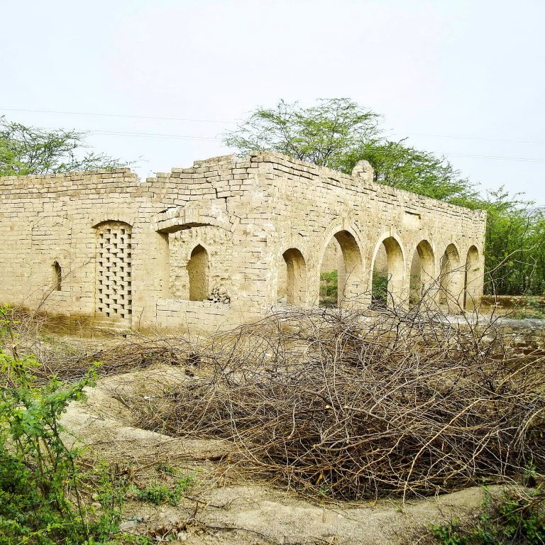 Village mosquesCentury-old village mosques survive in the countryside around Bannu, simple buildings still used for daily prayers.
A Short History of Bannu
1st millennium BCE
Akra
A large settlement grows at Akra on the Bannu plain; finds from around 300 BCE show its links along routes to Central Asia.
Ancient and medieval
A route into the plains
The Kurram–Bannu corridor is used by armies and migrants entering the subcontinent from the north-west.
1848
Edwardes's fort
Lieutenant Herbert Edwardes founds a fort and military base, and the town of Dalipnagar grows around it.
1869
Edwardesabad
The town is renamed after its founder.
1903
Bannu
The town takes the name of its plain and district, Bannu.
1962
Kurram Garhi project
An irrigation, power and flood-control scheme on the Kurram is completed, supporting the plain's farms.
2005
University
The University of Science and Technology Bannu opens as the town's first public university.
Getting There and Around
By road
Indus Highway junction
Bannu is at a junction of roads from Kohat and Peshawar, from the Indus and D.I. Khan, and west into North Waziristan. Use main roads only and travel in daylight.
By air
Via Peshawar or Islamabad
There are no regular commercial flights to Bannu; the nearest major airports are at Peshawar and Islamabad.
By rail
No practical service
The old railway links to Bannu are not a practical way to travel today; come by road.
Around town
Rickshaws
Rickshaws and minibuses serve the town. Travel with local hosts who know current conditions.
Plan Your Visit
Best time to visit
November to February
Winters are mild; from May to September the plain is very hot.
Etiquette
Conservative society
Bannu is a traditional Pashtun town. Dress very modestly, do not photograph women, and always ask before photographing men or homes.
Where to stay
Very limited
There are few hotels suitable for visitors. Most people who come to Bannu stay with family or hosts.
Safety and Advisories
Bannu and the districts bordering North Waziristan have suffered repeated militant attacks in recent years, including on security installations, and curfews or road closures can be imposed at short notice. Many foreign governments advise against travel to this part of Khyber Pakhtunkhwa. Check current government travel advisories and local authority guidance before planning any trip; foreign visitors should confirm NOC requirements and follow police instructions.


Frequently Asked Questions
What is Bannu famous for?
Above all, Bannu beef pulao. The town is also known for its fertile Kurram River plain, its British-era fort and cantonment, and as the gateway to North Waziristan.
What is the population of Bannu?
The 2023 Census counted 48,398 people within the city's municipal limits and cantonment (41,015 and 7,383) and 1,357,890 in Bannu District. The wider built-up area is larger than the municipal limits.
Who founded Bannu?
The modern town was founded in 1848 by the British officer Herbert Edwardes as a military base. It was called Dalipnagar, then Edwardesabad from 1869, and Bannu from 1903.
What is Bannu pulao?
A pulao of large, bone-in beef pieces slow-cooked into a rich stock and combined with long-grain rice cooked in ghee and whole spices, garnished with fried onions and green chillies.
Is it safe to visit Bannu?
The area has seen serious militant violence in recent years. Check current travel advisories and local authority guidance before considering a visit.
Keep Exploring
Related places and stories on DailyLife.pk
 KohatKohat city guide: the Kohat Pass and tunnel, Tanda Dam wetland, guava orchards
 Dera Ismail KhanD.I.
 PeshawarPeshawar city guide: Qissa Khwani Bazaar, Mahabat Khan Mosque, Sethi House, Peshawar Museum, Pashtun food
 The British Colonial EraBritish rule in Pakistan 1843–1947: conquest of Sindh and Punjab, the North-West Frontier, railways, canal colonies
 Rivers and Lakes of PakistanPakistan's rivers and lakes: the Indus and its tributaries, the Indus Waters Treaty, Attabad, Saiful Muluk
 Pashtun CuisinePashtun food guide: chapli kebab, dumba karahi, namkeen and tikka, pulao, siri paye and kahwa
How we know this
- Type Place guide
- Sources 5 (2 official/academic)
- Reviewed October 2026
- Disputed points None
5 sources
- Pakistan: Khyber Pakhtunkhwa – cities, towns and districts (Census 2017 and 2023), City Population (Thomas Brinkhoff), citing Pakistan Bureau of Statistics
- Census 2023 – Table 2: Population of urban localities, Khyber Pakhtunkhwa, Pakistan Bureau of Statistics
- Bannu, Encyclopaedia Britannica
- Bannu pulao, Wikipedia (used to locate primary sources)
- Bannu, Wikipedia (used to locate primary sources)
Photo credits (6)
- Akra Mound from canal side.jpg, Bordertimespakistan, CC BY-SA 4.0, via Wikimedia Commons
- A street scene in Bannu Pakistan.jpg, Omer Wazir, CC BY-SA 2.0, via Wikimedia Commons
- Bannu, Pakistan.jpg, Omer Wazir from Tucson, AZ, USA, CC BY-SA 2.0, via Wikimedia Commons
- Meryan Gate of Bannu, Pakistan.jpg, Omer Wazir from Tucson, AZ, USA, CC BY-SA 2.0, via Wikimedia Commons
- Bannu Kuram River.jpg, WahBannu, CC BY-SA 4.0, via Wikimedia Commons
- About a 100 years old village Mosque Bannu.jpg, Naveedanjumkhan, CC BY-SA 4.0, via Wikimedia Commons
