
City guide
Mansehra: Gateway to the Kaghan Valley
A Hindko-speaking market town in the green hills of Hazara, where Ashoka's edicts are carved into boulders and the roads to the Kaghan Valley and the Karakoram Highway divide.
- Khyber Pakhtunkhwa (Hazara Division)
- Altitude about 1,100 m
- On the Karakoram Highway
- Best season: March–June, September–November
Mansehra, Hazara, Khyber Pakhtunkhwa
Mansehra at a Glance
About Mansehra
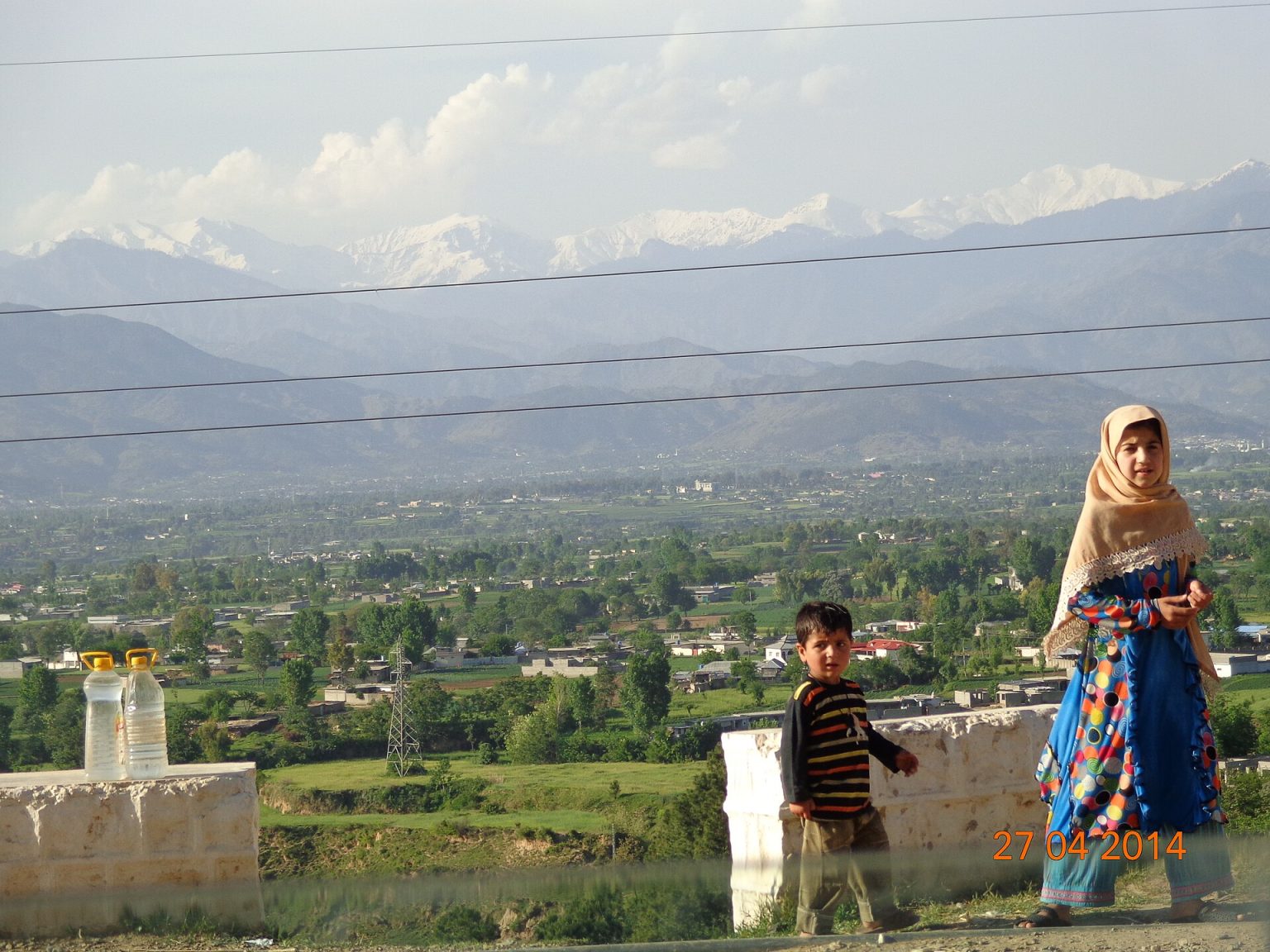
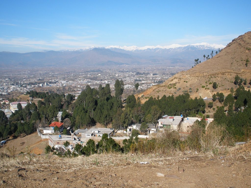
Mansehra stands at the southern end of the Pakhli plain in the hills of Hazara, about 19 km north of Abbottabad and roughly 1,100 metres above sea level. Pine-covered ridges surround the town, and the Bhut stream, a tributary of the Siran River, runs past it. It is the headquarters of Mansehra District, which stretches north through the Kaghan Valley to the Babusar Pass.
The 2023 Census counted 137,278 people in the city and 1,797,177 in the district. Hindko is the first language of most townspeople, with Pashto and Urdu also widely spoken; the Swati Pashtuns have long been prominent landholders in the surrounding countryside.
Mansehra is above all a crossroads. The Karakoram Highway runs through the town on its way north to Thakot, Besham and Gilgit, while the N-15 branches off towards Balakot, Naran and the Kaghan Valley, so in summer its bazaars fill with families heading for the lakes. Around the town, the hills grow maize, wheat, potatoes, rice, fruit and tobacco, and a government sheep farm operates at Jaba.
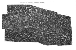
Visitors who stop will find one of Pakistan's most important ancient monuments on the edge of town: three great boulders carved with the fourteen major edicts of the Mauryan emperor Ashoka in the 3rd century BCE. Hazara University, founded in 2002, has also made Mansehra a student town.
Most travellers rush through Mansehra on the way to the lakes of Kaghan, but its boulders hold some of the oldest writing in South Asia.
Things to See in and Around Mansehra
Ancient inscriptions, green valleys and the road north.
 Ashoka's Rock EdictsFourteen edicts of the emperor Ashoka, written in the Kharosthi script and carved on three boulders at the foot of Bareri Hill. They set out his ideas of dharma and are on UNESCO's Tentative List.
 Hazara UniversityFounded in 2002 on the outskirts of town, the university draws students from across Hazara.
 The Pakhli plainThe fertile plain north of town, the historic name of the whole region, is patterned with maize and wheat fields beneath forested ridges.
 Kaghan ValleyMansehra is the gateway to Naran, Lake Saiful Muluk and Babusar. The valley road runs for more than 150 km along the Kunhar River beneath peaks of up to about 5,200 m.
 Mansehra bazaarThe bazaars along the highway sell cloth, shoes and hardware, and roadside stalls offer herbs, roots and remedies gathered in the hills.
A Short History of Mansehra
Mid-3rd century BCE
Ashoka's edicts
The Mauryan emperor Ashoka has his fourteen major edicts carved on boulders near the town, on a route through the north-west of his empire.
Medieval period
Pakhli
The region is known as Pakhli; after the Timurid invasion of 1399 the name Hazara comes into use.
Mughal era
A town on the plain
Local tradition credits the founding of the town to Raja Man Singh, a governor under Akbar; it is later re-established by the Swatis.
1818
Sikh rule
The Sikh Empire brings Hazara under its control.
1846–1849
British rule
Hazara passes to the British as the Sikh state collapses.
1976
District headquarters
Mansehra becomes the headquarters of a new district carved out of Hazara.
2002
Hazara University
Hazara University opens, making Mansehra a centre of higher education.
Getting There and Around
By road
Hazara Expressway and KKH
From Islamabad, take the Hazara Expressway (E-35) or the Karakoram Highway via Abbottabad. The N-15 to Balakot and Naran leaves the KKH at Mansehra. Expect heavy traffic on summer weekends.
By air
Via Islamabad
The nearest airport is Islamabad International Airport; continue by road.
By coach
Wagons and buses
Coaches and wagons run from Rawalpindi and Islamabad, and onward to Balakot, Naran and the KKH towns.
Around town
Rickshaws
Rickshaws and local wagons serve the town; for the Kaghan Valley, a car or jeep with a local driver is best.
Plan Your Visit
Best time to visit
Spring and autumn
March to June and September to November are pleasant. The upper Kaghan road usually opens only in summer; check its status before setting out.
Winter
Cold, occasional snow
Winters are cold and the town sometimes sees snow; higher roads in the district can be closed.
Where to stay
Mansehra, Balakot or Abbottabad
There are hotels in Mansehra, but most visitors stay in Abbottabad or press on to Balakot and Naran.
Etiquette
Modest dress
Hazara is conservative; dress modestly and ask before photographing people.
Advisories
Weather and roads
Mansehra is a well-travelled town. For onward travel, check monsoon landslide warnings, road conditions on the KKH and N-15, and current local authority guidance.

Mansehra Through Time
Every dated moment our guides record about Mansehra, from its own history and from national events that touched it. Each entry links to its source page.
- 1978
Karakoram Highway
The highway through the mountains to Mansehra is completed, transforming trade, travel and tourism in the region.
- 1986
Research at Shinkiari
A national tea research station was established at Shinkiari in Mansehra district, Khyber Pakhtunkhwa, to test whether tea could be grown commercially in Pakistan.
- 8 October 2005, 8:50 a.m.
2005 Kashmir Earthquake
On the morning of 8 October 2005 a magnitude 7.6 earthquake struck near Muzaffarabad, devastating Azad Jammu and Kashmir and northern Khyber Pakhtunkhwa. More than 73,000 people were killed in Pakistan by official count (other estimates exceed 86,000) and about 3 million were left homeless,…
Do you remember Mansehra as it used to be? Share a memory or an old photo, our editors review every story before it appears.
Frequently Asked Questions
What is Mansehra famous for?
Ashoka's rock edicts, its position as the gateway to the Kaghan Valley and Naran, Hazara University, and its green hill setting on the Karakoram Highway.
What is the population of Mansehra?
The 2023 Census counted 137,278 people in Mansehra city and 1,797,177 in Mansehra District (Pakistan Bureau of Statistics).
Where are the Ashoka rock edicts in Mansehra?
On three large boulders at the foot of Bareri Hill on the edge of the town. They record Ashoka's fourteen major edicts in Kharosthi script and date to the mid-3rd century BCE.
How far is Mansehra from Abbottabad?
About 19 km to the north, along the Karakoram Highway.
What language is spoken in Mansehra?
Hindko is the main language in the city, with Pashto and Urdu also widely spoken.
Keep Exploring
Related places and stories on DailyLife.pk
 Naran–KaghanNaran–Kaghan guide: Saiful Muluk, Lulusar, Babusar Top, Shogran and Siri Paye, with road seasons
 MurreeMurree travel guide: Mall Road, Holy Trinity Church, Patriata, Nathia Gali and Ayubia, with seasons, routes
 AbbottabadAbbottabad city guide: Ilyasi Mosque, Shimla Hill, Thandiani, Harnoi, the Galiyat, history since 1853
 HaripurHaripur city guide: Harkishangarh Fort, Tarbela Dam, Khanpur Lake, the Bhamala stupa, history since 1822, food
 IslamabadIslamabad travel guide: Faisal Mosque, Pakistan Monument, Margalla Hills trails, Saidpur, markets, sectors, Metrobus
 GilgitGilgit city guide: Kargah Buddha, bazaars, polo, 1947 history, Naltar and Rakaposhi day trips
How we know this
- Type Place guide
- Sources 6 (3 official/academic)
- Reviewed October 2026
- Disputed points None
6 sources
- Pakistan: Khyber Pakhtunkhwa – cities, towns and districts (Census 2017 and 2023), City Population (Thomas Brinkhoff), citing Pakistan Bureau of Statistics
- Census 2023 – Table 2: Population of urban localities, Khyber Pakhtunkhwa, Pakistan Bureau of Statistics
- Mansehra, Encyclopaedia Britannica
- Mansehra Rock Edicts (Tentative List), UNESCO World Heritage Centre
- Hazara University, Wikipedia (used to locate primary sources)
- Mansehra, Wikipedia (used to locate primary sources)
Photo credits (7)
- Mansehra Valley.JPG, User:Rehmat ullah saeed, CC BY-SA 3.0, via Wikimedia Commons
- View of Mansehra city.jpg, Marium kashif, CC BY-SA 3.0, via Wikimedia Commons
- Mansehra 13-14 Edicts.jpg, Eugen Hultzsch (29 March 1857 - 16 January 1927) Publication date 1925, Public domain, via Wikimedia Commons
- Hazara University Mosque.jpg, IamAnisurrahman, CC BY-SA 4.0, via Wikimedia Commons
- Mansehra hill view.jpg, Faiza, CC BY-SA 4.0, via Wikimedia Commons
- Various herbs and native medicines at roadside Mansehra town.JPG, Rangbaz, CC BY-SA 3.0, via Wikimedia Commons
- Naran , Kaghan Valley , KPK , Pakistan.jpg, Mimalkera, CC BY-SA 4.0, via Wikimedia Commons
